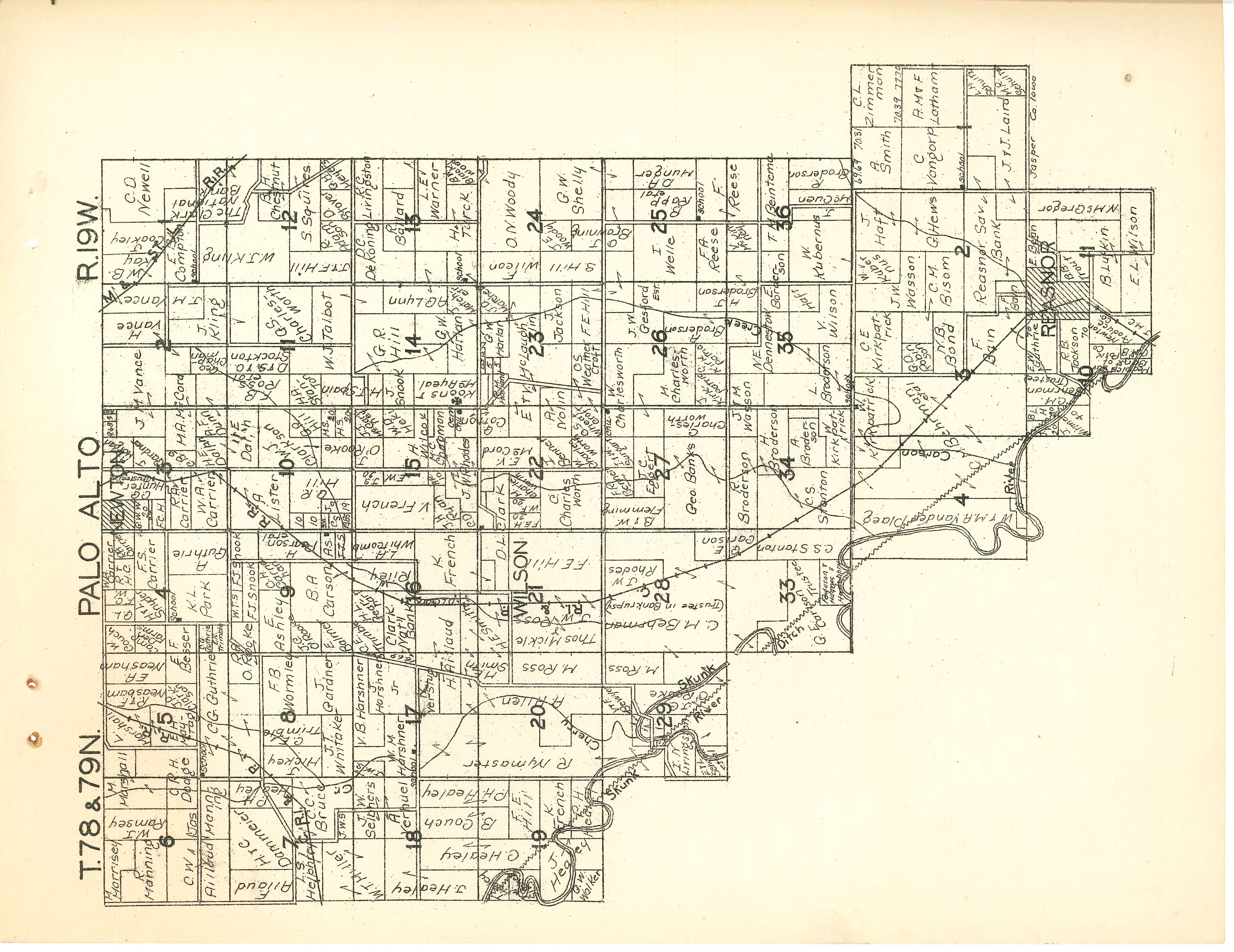
In today’s world, every piece of land is owned by somebody. In order to draw the lines and make the plat maps that define the land, a framework has to be in place so that the land can be described precisely and mapped accurately.
In the Midwest, where the land is generally rolling prairie laced with streams and rivers, the land was surveyed and mapped, so the U.S. Government could sell the land and divvy up ownership among the European settlers. The Land Ordinance of 1785 laid down the rules for this mapping. The scheme was to divide the land into square mile grids. A square mile comprises 640 acres and was positioned as close as possible to align with the cardinal directions. Thirty-six square-mile boxes on a map, arranged six by six, made a township. Each square mile within the township made a numbered section, and each section was divided into four quarters, named northeast, southeast, northwest and southwest quarters. Each quarter section contained 160 acres, and was often the initial claim or purchase of a 19th-century farmer. A land buyer or speculator might also divide up the quarter into four 40-acre plots which are also designated by their position within the 160-acre quarter as northeast, northwest, southeast and southwest quarters. (It gets a bit confusing!) In time pieces of land were sold off, often by 40 or 80-acre chunks. And sometimes natural features such as rivers had to be accommodated in irregular shapes. So you might see a description that reads: “… in the southeast quarter of the northwest fractional quarter of section 7, township 79 north, range 19 west of the fifth principal meridian …”
The earliest records of land ownership in the area that would become Palo Alto township described 40 acres claimed by Thomas Reece in January of 1848.
By 1854, land in what is now Jasper County, Iowa, had been surveyed and platted sufficiently to start selling it off to buyers from the East. Some were farmers hoping for more land to farm. Others were speculators hoping to turn a profit.
In 1854, Jesse Reeves bought 167 acres from the Government for $1.25 per acre or $208.75. 147 years later, Owl Acres would be carved out of that land. At some point before 1871, Jesse sold the eastern half of his land to his neighbors the Woodruffs. The Woodruffs also bought the 80 acres adjacent to the Reeves land, for a total of 160 acres. In 1888 the Carrier brothers, sons of a prominent landowner and community leader in the area, bought the same 160 acres from the Woodruffs. They most likely bought it as an investment, because they flipped it, selling it to the Dammeier brothers, two years later in 1890 for $5,100.
Over time, the Dammeier brothers located two home places on the land, one in the southwest corner, and one closer to the southeast corner. Each home place would include a house, a barn, and several outbuildings including a corncrib, a milk house, and machinery buildings. 110 years and four generations later, 8 acres of the home place in the southwest corner of the property were carved out, rezoned residential, and put up for sale for a rural home. The surrounding fields remained in the Dammeier family and continued to be farmed. Thus Owl Acres was created.
2 comments
I think I identified the location of Owl Acres. I’ve seen platt maps before, and they are hard to read
Old plat maps hold a lot of information.